From ground level, a home is four walls, a roof, and a yard. From 200 feet up, it’s a lifestyle — the tree-lined street, the park across the road, the creek running along the property line, the proximity to downtown.
That shift in perspective is exactly why drone photography has become one of the fastest-growing services in real estate marketing. Listings with aerial photos sell 68% faster and attract significantly more online engagement than those with ground-only photography.
But drone photography isn’t right for every listing, and not every drone operator is qualified to shoot real estate. This guide covers when aerial shots are worth the investment, what they actually cost, how to evaluate a drone photographer, and the FAA regulations every agent should understand.
When Drone Photography Is Worth It
Drone photos add the most value when location or lot size is a selling point. Ask yourself: would a buyer’s decision be influenced by what’s around the property, not just what’s inside it?
Always Worth It
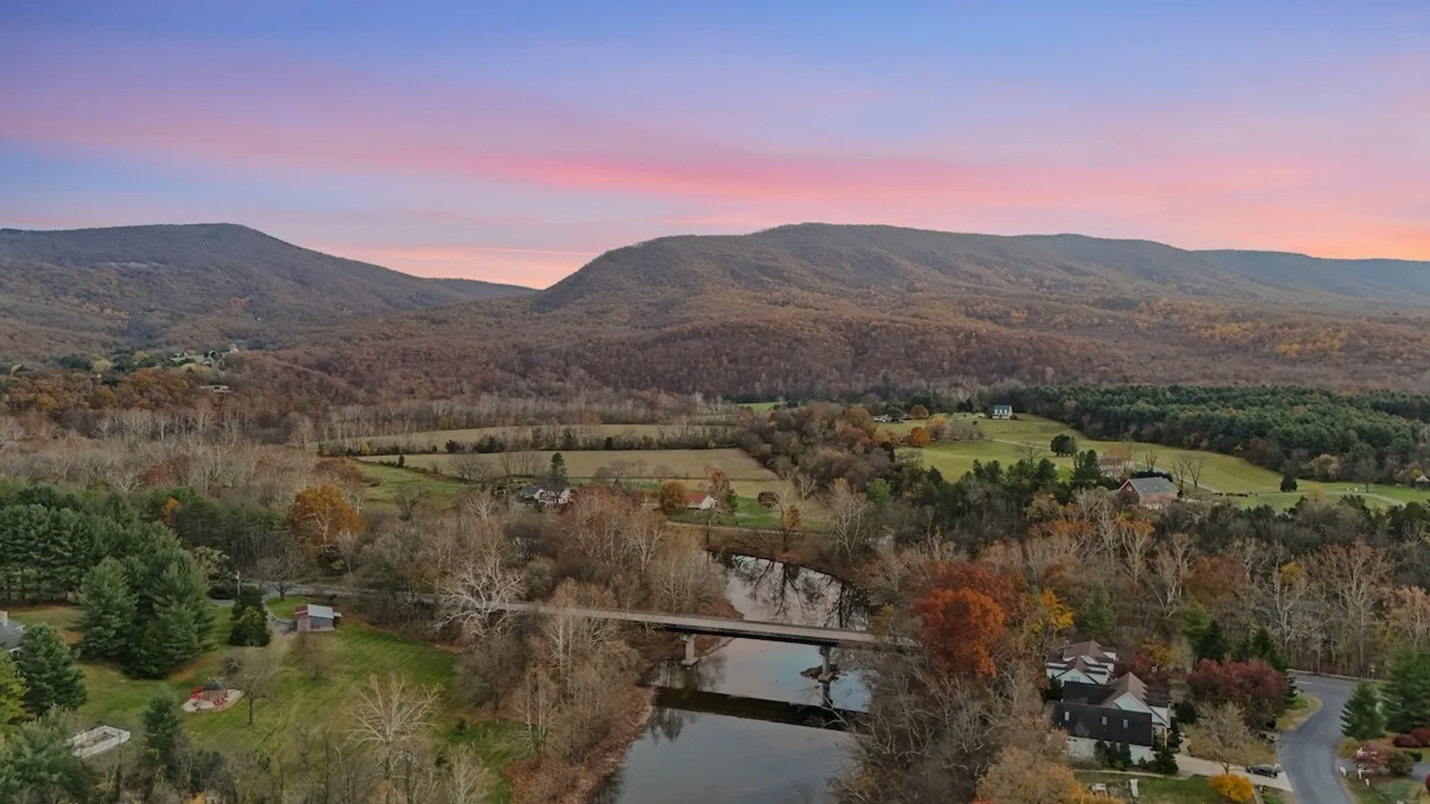
- Large lots and acreage — aerial shots show the full scope of the property that ground-level photos can’t capture
- Waterfront properties — river, lake, or ocean views from above are some of the most compelling listing images
- Properties with pools, outdoor living spaces, or landscaping — show the full outdoor layout in context
- Homes near parks, golf courses, or trails — buyers want to see proximity to amenities
- Corner lots or unique positioning — aerial views show lot shape, privacy, and neighbor relationships
- Rural or suburban properties — open space, farm views, and natural surroundings are best captured from above
- New construction or developments — show the community layout, nearby infrastructure, and construction progress
Sometimes Worth It
- Suburban neighborhoods — depends on the specific location and what’s nearby
- Urban homes with rooftop decks or terraces — can be compelling if the skyline view is a feature
- Homes near highways or busy roads — careful framing is needed so aerial shots help rather than hurt
Usually Not Needed
- Interior condos or apartments — the building exterior and common areas matter more than aerial context
- Townhouses in dense rows — limited differentiation from above
- Properties where the location is a weakness — don’t highlight proximity to power lines, commercial buildings, or busy intersections
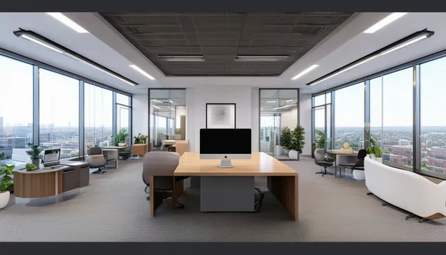
What Drone Photography Includes
A standard real estate drone photography package delivers:
- 5-15 aerial photos at various altitudes (typically 50-400 feet)
- Multiple angles — straight-down (bird’s eye), angled perspective, and panoramic views
- Professional editing — color correction, sky enhancement, exposure balancing
- Property-in-context shots — showing the home’s relationship to its surroundings
- MLS-ready files — properly sized and formatted for upload
Advanced Drone Services
Beyond still photos, drone technology enables:
- Aerial video — smooth cinematic flyovers set to music for listing videos and social media. Learn about videography services →
- 360-degree aerial panoramas — interactive views that let buyers look around from above
- Twilight/sunset aerials — dramatic shots with the home lit up at dusk and a colorful sky
- Construction progress documentation — periodic flyovers to document building phases
- Property surveys — overhead shots for measuring lots, planning renovations, or documenting boundaries
How Much Does Drone Photography Cost?
| Service | Typical Cost | What You Get |
|---|---|---|
| Aerial photos only | $100-$250 | 5-15 edited aerial stills |
| Aerial photos + video | $200-$500 | Photos + 30-90 second aerial video |
| Bundled with interior photography | $250-$400 total | Ground + aerial photos in one visit |
| Full media bundle | $500-$1,500 total | Photos + drone + video + 3D tour |
Bundling drone photography with your standard real estate photography package is almost always the best value. One provider, one appointment, and 15-25% savings compared to booking separately.
FAA Regulations Every Agent Should Know
Drone photography for real estate is commercial drone use — which means it’s regulated by the Federal Aviation Administration. These aren’t optional guidelines. They’re federal law.
The Basics
- Part 107 certification is required. The drone operator must hold a current FAA Remote Pilot Certificate. This involves passing an aeronautical knowledge test and renewing every 24 months. Always ask to see certification before hiring.
- Registration is required. The drone itself must be registered with the FAA and display its registration number.
- Insurance is recommended. Professional operators carry liability insurance (typically $1M coverage). If a drone damages property or injures someone, you want to know insurance is in place.
Flight Rules
- Maximum altitude: 400 feet above ground level
- Visual line of sight: the operator must be able to see the drone at all times
- Daylight operations: flights are permitted from 30 minutes before sunrise to 30 minutes after sunset (with anti-collision lights during twilight)
- People and vehicles: the drone cannot fly directly over people who aren’t involved in the operation
- Restricted airspace: many areas near airports, military bases, and government buildings require prior authorization
DC-Area Specific Restrictions
The Washington DC metropolitan area has some of the most complex airspace in the country:
- The DC Flight Restricted Zone (FRZ) covers a 15-nautical-mile radius around Reagan National Airport. Drone flights within this zone require special authorization that most operators cannot obtain
- Much of Arlington, Alexandria, and parts of Fairfax County fall within restricted zones due to proximity to the Pentagon, Reagan Airport, and federal facilities
- Northern Virginia suburbs (Reston, Herndon, Ashburn, Loudoun County) and Maryland suburbs (Bethesda, Rockville, Silver Spring) are generally flyable with standard LAANC authorization
- Always confirm with your drone operator before booking — a qualified professional will know whether they can fly at your specific property address
What Happens If the Drone Isn’t Legal?
If an unlicensed or unauthorized drone is used for your listing:
- The operator faces FAA fines up to $32,666 per violation
- The footage may need to be removed from your listing
- You could face liability questions if an incident occurs on the property
- Your brokerage’s reputation is at risk
This is why verifying Part 107 certification is non-negotiable. A professional drone photographer will readily provide proof.
How to Evaluate a Drone Photographer
1. Verify FAA Certification
Ask for their Part 107 Remote Pilot Certificate number. If they hesitate, find someone else. No exceptions.
2. Review Aerial-Specific Portfolio
General photography portfolios don’t tell you much about drone skills. Look specifically for:
- Composition from above — are the shots thoughtfully framed, or just “camera pointing down”?
- Variety of altitudes and angles — good operators capture from multiple heights to tell a complete story
- Consistent exposure — skies should be well-exposed without blowing out (overly bright)
- Smooth video — if you’re considering aerial video, watch for jittery movement or abrupt transitions
- Real estate specific work — landscape photography from drones is a different skill than real estate aerial photography
3. Ask About Equipment
- Commercial-grade drone — DJI Mavic 3, Air 3, or Mini 4 Pro are common for real estate. Older consumer drones produce noticeably inferior results
- Camera resolution — 20+ megapixels for stills, 4K for video
- Obstacle avoidance sensors — essential for safety near buildings and trees
- Backup equipment — professional operators carry a backup drone in case of technical issues
4. Confirm Weather Policy
Weather is the top reason drone shoots get rescheduled. A good operator will:
- Monitor conditions before the shoot and proactively communicate
- Reschedule at no charge if conditions are unsafe
- Have flexibility in their schedule to accommodate weather delays
- Know the local microclimate patterns (afternoon winds, morning fog, etc.)
Getting the Best Results From Your Drone Shoot
Property Preparation
- Mow the lawn 1-2 days before the shoot — stripes and patterns show beautifully from above
- Clear the driveway and yard — move cars, trash cans, toys, and any clutter. Everything is visible from the air
- Turn on the pool equipment — clear, blue water photographs dramatically from above. Green or covered pools are a negative
- Move patio furniture into position — stage outdoor living areas as you would indoor rooms
What to Tell Your Drone Operator
Share specifics that help them plan the shoot:
- Key selling points (lot size, water features, proximity to amenities)
- Any airspace concerns they should research in advance
- Neighbor sensitivities (some neighbors are uncomfortable with drones — a heads-up helps the operator be considerate)
- Whether you also want aerial video or just stills
- Preferred orientation (which side of the property is most photogenic)
Best Time of Day
- Morning (8-10 AM): soft, warm light with long shadows that add depth and dimension. Best for east-facing homes
- Midday (11 AM-2 PM): even lighting, no harsh shadows. Good for overhead property-boundary shots, but flat for perspective shots
- Golden hour (1-2 hours before sunset): warm, dramatic light. Best for properties with western exposure or impressive sunset views
- Twilight (20-30 minutes after sunset): stunning with interior lights on. Premium service, usually at extra cost
Drone Photography in Your Listing Presentation
Drone photos aren’t just for buyers — they’re a listing tool. When you present a seller with a marketing plan that includes aerial photography, you’re demonstrating a premium approach that competitors may not offer.
Include sample drone shots in your pre-listing presentation to show sellers what their marketing will look like. Homeowners with large lots, pools, or scenic surroundings are often thrilled to see their property from a perspective they’ve never experienced themselves.
Ready to add aerial photography to your listings? Explore UMedia’s drone photography packages — FAA-certified operators, next-day delivery, starting at $119.